
Political Maps


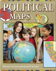
Political Maps
Political Maps are more often the first type of map that children learn about. These maps show the boundaries of countries, states or provinces, cities and physical features such as lakes and oceans. Readers will understand with the Political Maps book how to use political maps to solve problems. How? All thanks to detailed, up-to-date maps and clearly written text! Political Maps come in a variety of sizes, as you might expect. Some cover entire continents, while others are regional and cover much smaller areas, such as a state or a county. Without a Political Maps, it is possible to be unaware of the size of a country, state or region. Knowing the location of political boundaries is critical in determining who controls a region and its natural resources. Political boundaries have been a source of territorial disputes between nations, particularly where borders have not been clearly defined. To resolve such disputes, the International Court of Justice and other international bodies rely on political maps. You've probably seen a lot of political maps in your life. The key to using these maps is understanding how to read them. The Political Maps book can help you with that!